How to Use WeedFutures
Who should use this website?
This website is useful for those involved in natural resource management in Australia, including climate change adaptation, vegetation management and weed control e.g. local councils, private land holders, federal, state and territory parks' personnel, policy makers, the agriculture sector, and the nursery industry (for risk assessments).
N.B. The information given below refers to the 711 naturalised and invasive plant species analysed in Weedfutures. Not all naturalised and invasive plant species in Australia have been analysed. See Methods for more information. Habitat suitability is based on the output of species distribution models largely based on global climate models - see Methods for more information.
How to search for a species by weed classification
How to assess if a naturalised species is currently occupying all of its climatically suitable habitat
For example, does Briza maxima currently occupy all of its climatically suitable habitat in NSW? On the home page, click on Search by species. Begin typing Briza maxima in the search box until the species name appears below and then click on the name. Scroll down to Maps of habitat suitability and recorded occurrences (Figure 1).
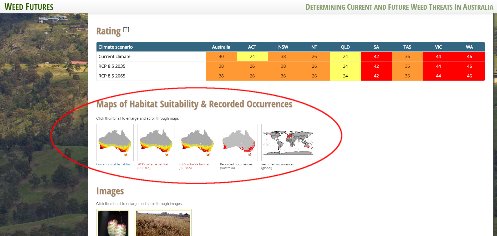
Figure 1. Species profile page for Briza maxima
The first map shows where the climate is currently suitable for the species in Australia. The dark red shading represents the most suitable areas, through to yellow, and to grey (not suitable). Click on the maps to enlarge. According to these records, Briza maxima occurs in the most climatically suitable habitat but does not occupy all suitable habitat.
Maps two and three are projections of habitat suitability for Briza maxima in 2035 and 2065 respectively under an 8.5 RCP scenario. On the fourth and fifth maps, the red dots represent the locations where the species has been recorded in Australia and globally respectively.
Additional information is also given on this page. Click on the table above for an indication of the likelihood of population establishment and expansion of the species. For example, in NSW, by 2065, the potential for the likelihood of population establishment and expansion of Briza maxima species is unchanged, with a medium rating (but a decrease in score values of 38 to 36). Click on the ? icon next to Rating at the top of the table for more information (Figure 2) and/or refer to the Methods section.
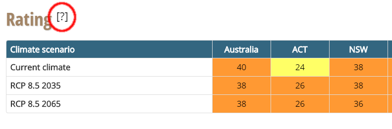
Figure 2. Click on the ? for more information
The Species profile section provides additional information that can also be used to further assess risk and prioritise management actions.
How to assess if an invasive plant species is currently occupying all of its climatically suitable habitat
For example, does Asparagus declinatus currently occupy all of its climatically suitable habitat in South Australia?
For invasive species, the process to answer this question is the same as for naturalised species.
On the home page, click on Search by species. Begin typing Asparagus declinatus in the search box until the species name appears below and then click on the name. Scroll down to Maps of habitat suitability and recorded occurrences (Figure 3).
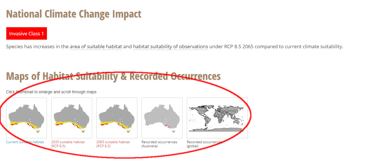
Figure 3. Maps of suitability and recorded occurrences for Asparagus declinatus
The first map shows where the climate is currently suitable for the species in Australia. The dark red shading represents the most suitable areas, through to yellow, and to grey (not suitable). Click on the maps to enlarge. According to these records, Asparagus declinatus does not occupy all suitable habitat.
Maps two and three are projections of habitat suitability for Asparagus declinatus in 2035 and 2065 respectively under an 8.5 RCP scenario. On the fourth and fifth maps, the red dots represent the locations where the species has been recorded in Australia and globally respectively.
Additional information is also given on this page. However, unlike naturalised species, which show the likelihood of population establishment and expansion, invasive species are categorised into three classes based on changes to the area of suitable habitat and within that area, the average habitat suitability values, at the national level. Class 1 is an increase in both the area of habitat suitability and suitability values of that area are projected. For Class 2, an increase in either is projected and for Class 3, a decrease in either or no change is projected.
Asparagus declinatus has been evaluated as a Class 1 invasive species. This evaluation means that increases in suitable habitat and habitat suitability are projected for 2065, compared to current habitat suitability. This species should be prioritised for more comprehensive assessment and management. See the Methods section for more information.
How to find which naturalised and invasive plant species are suited to the current climate conditions of my region
For example, I live in the Lismore City Council LGA and I want to know which of the naturalised and invasive plant species that occur in my region are listed on this website (and are therefore suited to the current climate in my region).
On the home page, click on Search by region. On the next page, click on LGA and then, start typing Lismore, and click on the name when it appears and a map of NSW appears outlining the Lismore LGA region (Figure 4).
Click on View habitat suitability data for this region (the tab on the map).
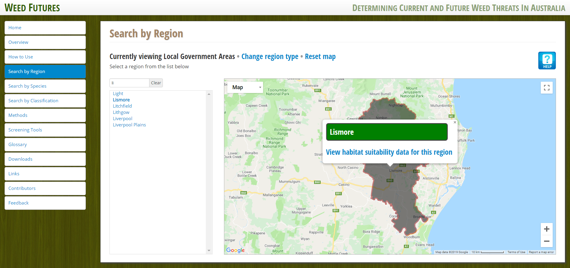
Figure 4. Map of the Lismore Local Government Area region
A new window with a list of species appears (Figure 5). If the species has been recorded in this region, a red leaf appears next to its name.
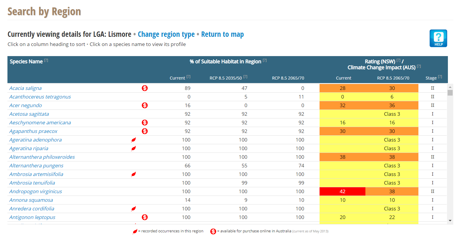
Figure 5. Species list for Lismore Local Government Area region
Scroll down this page to view a list of all of the species analysed for the Lismore LGA (Figure 6). There are two pieces of information. Firstly, the values for the percentage of climatically suitable habitat in the current and the future for the region, and secondly, the values of the screening tool for NSW.
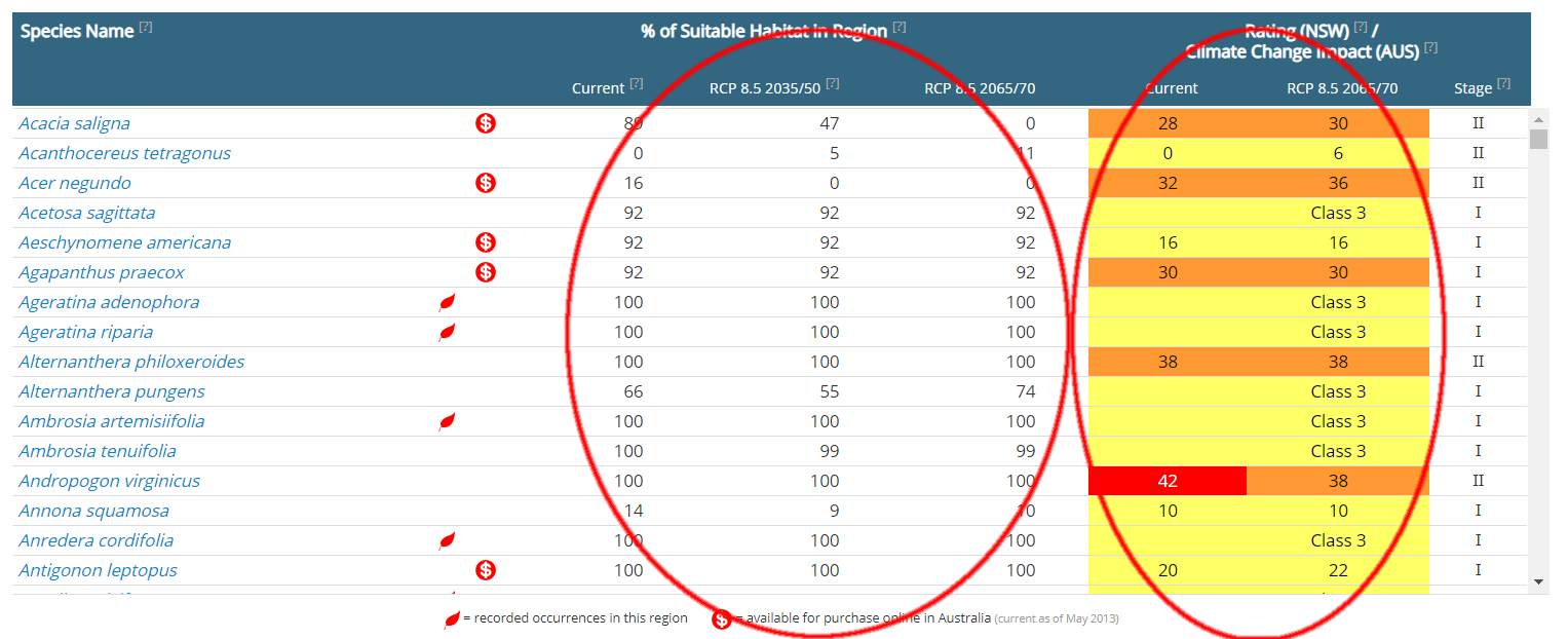
Figure 6. Species list for Lismore Local Government Area region
The value in the first Current column gives a value of the % of suitable habitat in the region for the species. For example, 100% of the region is considered suitable for Ageratina adenophora, to grow under current climate conditions and this remains unchanged through to 2065.
The second set of columns shows that Ageratina adenophora is evaluated as a Class 3 invasive species in NSW (see Methods and ? icons in table headings). This evaluation means that decreases in suitable habitat and habitat suitability are projected for 2065 in NSW, compared to current climate suitability.
In contrast, for Acanthocereus tetragonus, currently there is no climatically suitable habitat in this region, but its climatically suitable habitat is projected to increase in the future. However, the risk assessment for this species gives it a low likelihood for population establishment and expansion (see Methods and ? icons in table headings).
How to find which naturalised and invasive plant species are not suited to the current climate conditions of my region but may become suitable in the future
For example, I live in the Lismore City Council LGA and I want to know which naturalised and invasive plant species are not currently climatically suitable in my region but are projected to become climatically suitable in the future.
On the home page, click on search by region.
On the next page, click on LGA and then, start typing "Lismore", and click on the name when it appears and a map of NSW appears outlining the Lismore LGA region (Figure 7).
Figure 7. Map of the Lismore Local Government Area region
Click on View habitat suitability data for this region (the tab on the map).
A new window with a list of species appears (Figure 8). If the species has been recorded in this region, a red leaf appears next to its name.
Figure 8. Species list for Lismore Local Government Area region
Scroll down the list of species to view the % of suitable habitat in region (Figure 9). For example, Cenchrus incertus does not have a red leaf by its name and has not been recorded in this region. Currently there is no (0%) climatically suitable habitat in this region, but a small increase (5%) in its habitat suitability is projected for the future in the Lismore region. In NSW, the likelihood of population establishment and expansion is evaluated as medium, but unchanged (32). See Methods and ? icons in table headings for more information.
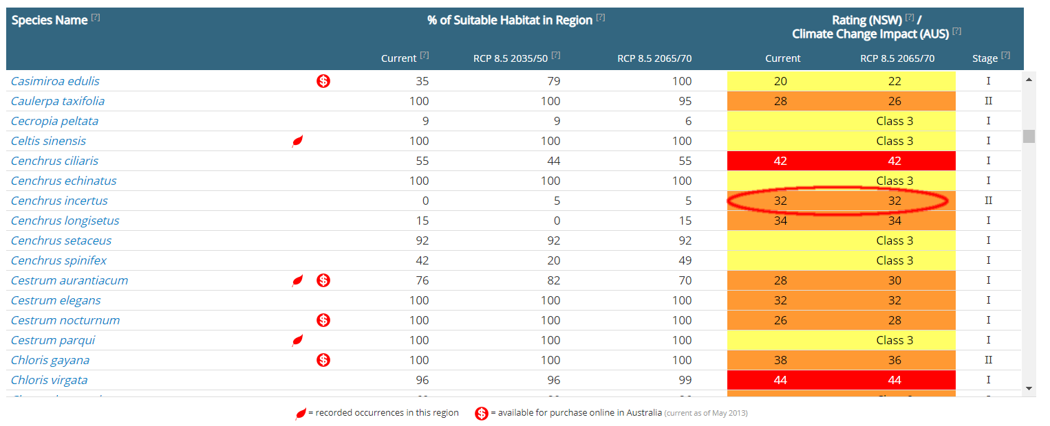
Figure 9. Species list for Lismore Local Government Area region
How to find which naturalised and invasive plant species are likely to experience a change (increase/decrease) in climate suitability in my region in the future
For example, I manage weed species in Dharawal National Park and I want to know which weeds in the Park are likely to become more prevalent or invasive.
On the home page, click on search by region.
On the next page, click on CAPAD and then, start typing "Dharawal", and click on the name when it appears. A map of NSW appears outlining Dharawal National Park (Figure 10).
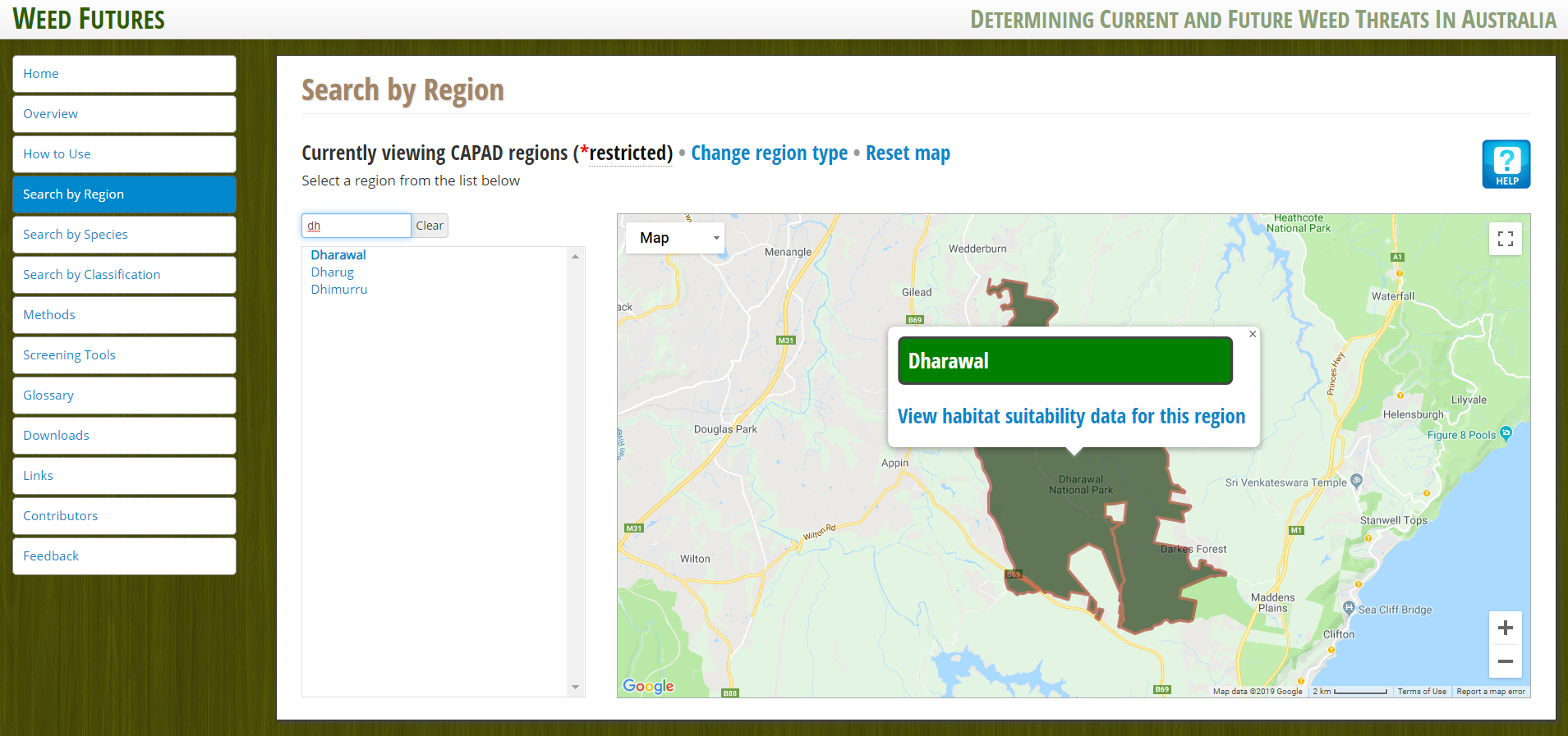
Figure 10. Map of the Dharawal CAPAD region
Click on View habitat suitability data for this region (the tab on the map) (Figure 11).
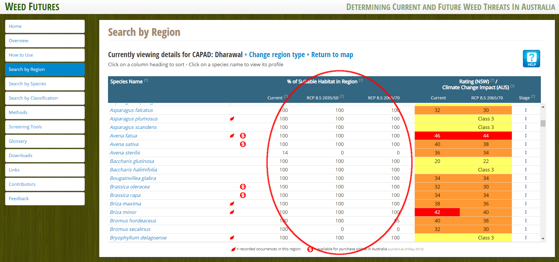
Figure 11. Species list for the Dharawal CAPAD region
For all of the species that have been recorded in Dharawal National Park, climatically suitable habitat is currently 100% and is unchanged in the future. Note that there are several species (i.e. Senecio jacobaea) that have not been recorded in the Park and currently have a high percentage of suitable habitat, becoming less so in the future (85% - 0%).
N.B. The columns on the right give the results of the screening tool that evaluates the likelihood of population establishment and expansion in NSW. For example, Avena fatua has a high potential for population establishment and expansion in NSW, although the actual value decreases from 46 to 44. If you were searching for a region in a different Australian state, the screening tool assessment would be relative to that state. See Methods and ? icons in table headings for more information.
How to assess the likely risk of population establishment and expansion in the future compared to now for a naturalised species
For example, I am in the Murray Local Land Services region and I want to assess the likelihood of future expansion in NSW of two grass species: Andropogon virginicus and Eragrostis curvula. Andropogon virginicus is a naturalised species and Eragrostis curvula is classified as an invasive species and the method used to analyse these species is different and separate instructions are given below.
On the home page, either click on the Search by species icon (scroll down the page and click Andropogon virginicus) or click on the Search by region icon and scroll down the Species Name list and click on Andropogon virginicus.
To view via the Search by species tab, start typing the name in the search box and then click on the name when it appears. A new window will appear with the species' profile, rating under future climate scenarios, maps of habitat suitability & recorded occurrences, images and a list of websites with further information. Scroll down to the Rating section (Figure 12).
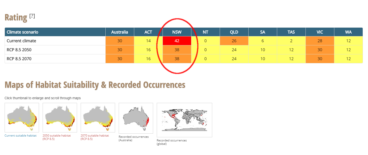
Figure 12. Rating information for Andropogon virginicus
Information about the species potential for population establishment and expansion is given using a traffic light system. Under the current climate, in NSW, Andropogon virginicus has a rating of 42 points and is coded red, meaning that there is a high risk of invasion. However, under both future climate scenarios, the risk is downgraded to medium (orange) at 38 points. This species was added to the database in Stage 2 of the project so the future dates are 2050 and 2070.
By viewing via the Search by region icon, habitat suitability data is also provided for the region (i.e. Murray LLS) (Figure 13). Nine percent of the region is currently considered as climatically suitable habitat for Andropogon virginicus. The area of suitability increases to 12% and 13% in 2050 and 2070 respectively. The differences in the direction of climatically suitable habitat for the region and the potential for population establishment and expansion differ, underscoring that these methods are based on different criteria. More information on the rating methodology can be found by clicking the [?] icon next to Rating or reading the Methods tab.
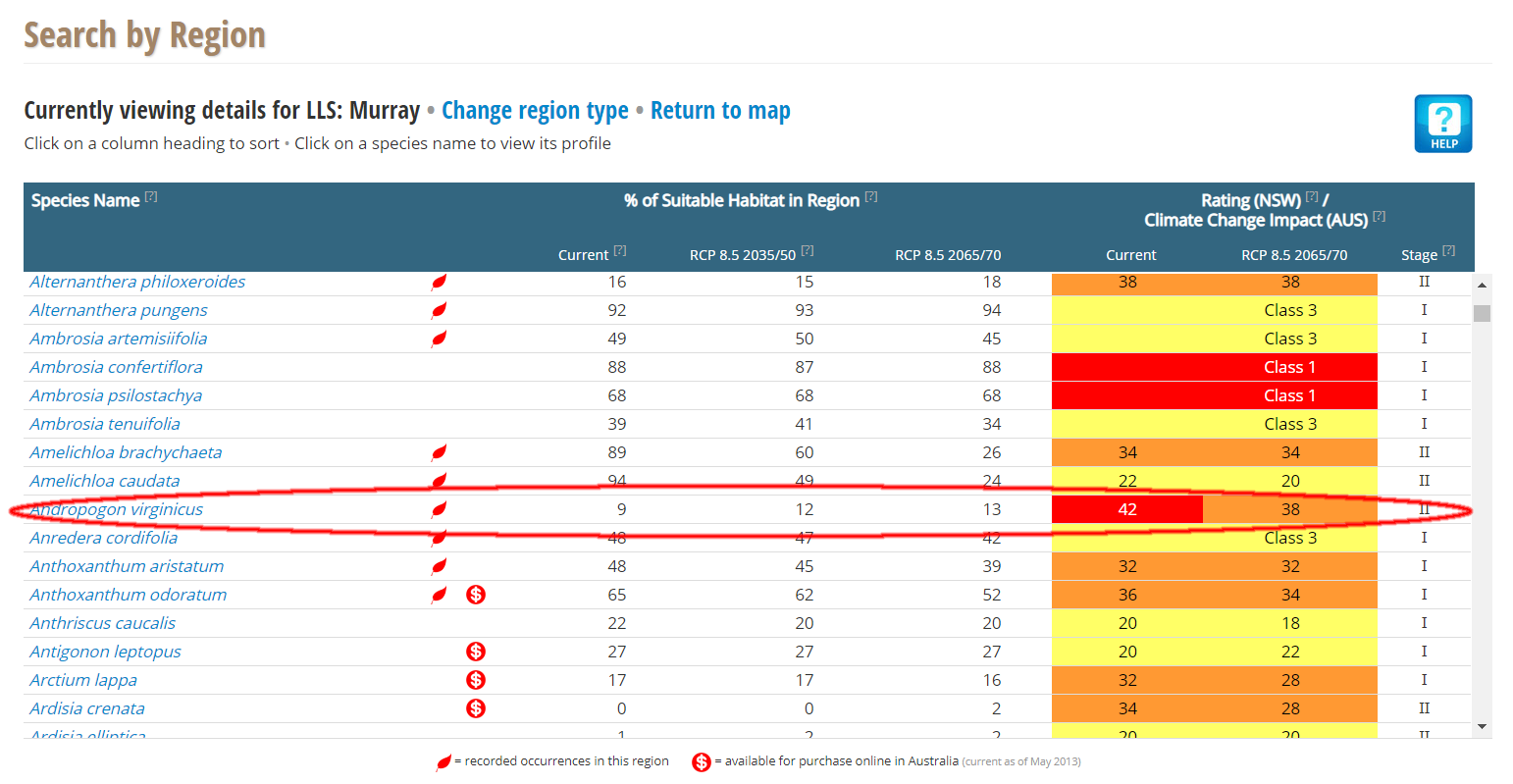
Figure 13. Species list for Murray Local Land Services region, highlighting Andropogon virginicus
How to compare the habitat suitability of invasive species between current climate and future climate
This system categorises invasive species into three classes based on changes to the area of suitable habitat and within that area, the average habitat suitability values, at the national level. Class 1 is an increase in both the area of habitat suitability and suitability values of that area are projected. For Class 2, an increase in either is projected and for Class 3, a decrease in either or no change is projected.
For example, Eragrostis curvula has been classified as a Class 3 invasive species (Figure 14). The area of suitable habitat and the habitat suitability values are projected to decrease or remain the same under RCP 8.5 2065 compared to current climate suitability.
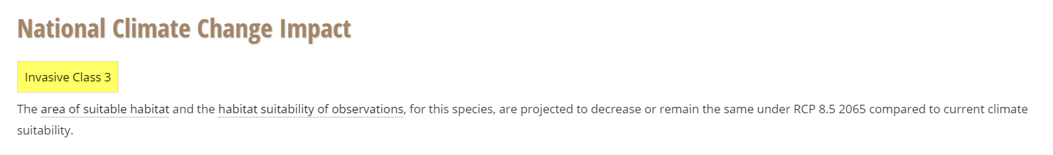
Figure 14. National Climate Change Impact for Eragrostis curvula
Conversely, Senna obtusifolia is a Class 1 invasive species (Figure 15). Therefore, if these two invasive species occurred in the same area, the Class 1 species should be prioritised for more comprehensive assessment and management.
More information on the rating methodology can be found in the Methods section.
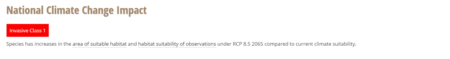
Figure 15. National Climate Change Impact for Senna obtusifolia
How to search for a species by weed classification
Several weed list classifications (e.g. WoNS: Weeds of National Significance) are available under Search by Classification (Figure 16). Click on the classification to view a list of species. However, many of these lists have now been superseded by new classifications. You can then look at its national rating for risk and link to its profile pages.
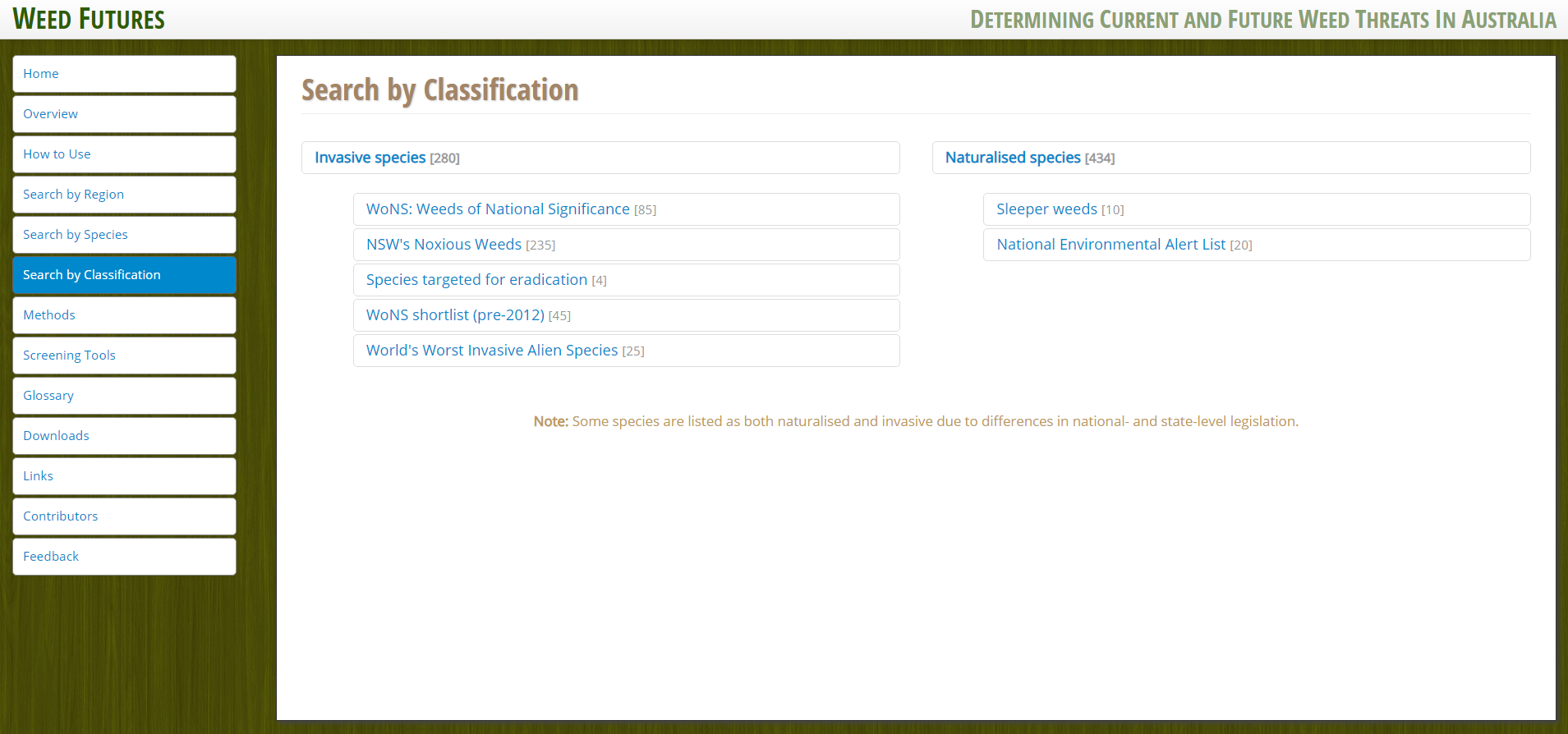
Figure 16. Search by weed list classification